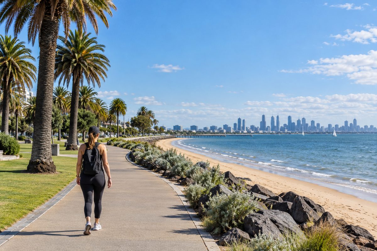
St Kilda to Middle Park Walk
The St Kilda to Middle Park walk is a flat foreshore stroll of roughly 2 to 3 km that most people finish in 30 to 45 minutes, and tram route 96 makes the return trip easy. The distance depends on where you start in St Kilda and where you stop in Middle Park. The real choice is which route you take. You can follow the bay, or you can cut inland past the lake. Each one suits a different kind of outing, and the tram turns either into a simple one-way walk.
This guide from St Kilda Almanac covers that choice, plus the details that make the walk work: where to start, where the facilities are, how the tram fits in and what catches people out. For more local guides, visit the St Kilda Almanac home page.
Which route should you take, the bay or the lake?
Take the bay route if you want sea views and the easiest walking. Take the lake route if you want shade, fewer cyclists and a quieter loop. For a first visit, the bay route is the better pick.
Both routes link St Kilda, Victoria with Middle Park, Victoria. Both are flat. Both sit inside the City of Port Phillip, so paths are sealed, signed and well kept. The difference is the feel of the walk.
The bay route
This is the classic version. You walk north-west along the foreshore path beside Port Phillip, with the water on your left the whole way. It starts near St Kilda Pier, passes the St Kilda Sea Baths, runs along the beach at St Kilda West and ends at the Middle Park beachfront.
The path is part of the Bay Trail, a shared path used by walkers, runners and cyclists. It is wide, sealed and easy for prams and wheelchairs. You are never far from a bench, a toilet block or a kiosk.
The lake route
This version heads inland. You walk up Fitzroy Street, Melbourne, cross into Albert Park and Lake, then follow the lake path north before turning west through the streets of Middle Park. It is longer, closer to 4 km depending on how much of the lake you circle.
The lake route trades sea breeze for trees, birdlife and calmer water. It feels more like a park walk than a beach walk. It also suits windy days, when the open foreshore can be cold and gusty.
A quick way to decide
- Sunny, calm day: walk the bay.
- Strong wind off the water: walk the lake.
- Walking with young kids: walk the bay, because there are more toilets and places to stop.
- Want a full loop with no tram: walk out along the bay and back via the lake.
Where does the bay walk start and finish?
Start at the base of St Kilda Pier on Jacka Boulevard. It is the clearest landmark, and every path along this stretch connects to it.
From the pier, head north-west with the water on your left. The St Kilda Sea Baths sit just past the pier. The building has cafes, a gym and a heated seawater pool, and it is a handy spot for a coffee before you set off.
Keep walking and Jacka Boulevard becomes Beaconsfield Parade. This is St Kilda West. The beach here is often called West Beach, and it is usually calmer and less crowded than the main St Kilda beach. One tip if you search for it online: West Beach, South Australia is a beachside suburb in Adelaide and tends to fill the results. Add "St Kilda" to your search to find the right stretch of sand.
Past St Kilda West, the foreshore runs into Middle Park. There is no sign telling you that you have crossed a suburb line. The houses along Beaconsfield Parade grow grander, and the beach widens. Most walkers treat the Middle Park beachfront, around Armstrong Street and Mills Street, as the finish. Keep going to Kerferd Road and you reach the edge of Albert Park, Victoria, which adds roughly another kilometre.
What you will pass on the way
- St Kilda Pier and its kiosk.
- The St Kilda Sea Baths complex.
- Open lawns and barbecue areas along Jacka Boulevard.
- The quieter beach at St Kilda West.
- Kiosks and beach clubs along the Middle Park foreshore.
How does tram route 96 turn this into a one-way walk?
Walk one way and ride Melbourne tram route 96 back. It is the simplest way to do this walk, and it is a detail many guides skip.
Route 96 runs between St Kilda and East Brunswick, passing through the Melbourne central business district. For most of its southern section it does not run on a street at all. It runs on the old St Kilda railway line, which closed as a train line in 1987 and was converted to light rail. The tram still glides along the former rail corridor, away from car traffic.
That old rail line runs parallel to the foreshore, a few blocks inland. It has a stop at Middle Park, near Canterbury Road, where the old station building still stands. From the Middle Park beachfront, it is a short walk inland to this stop.
From Middle Park, ride the tram south toward St Kilda. It travels along Fitzroy Street and ends on Acland Street, the main cafe and cake shop strip of St Kilda. The ride is short, usually under 10 minutes outside peak times.
Two ways to use the tram
- Walk out, tram back: walk the bay from St Kilda to Middle Park, then catch route 96 back to Acland Street for lunch.
- Tram out, walk back: start in the city, ride route 96 to Middle Park, then walk the bay south to finish at St Kilda Pier at sunset.
The second option suits visitors staying in the city. You end the day in St Kilda with the sun going down over the water, and you skip the backtrack entirely.
Check Public Transport Victoria for current timetables and any track works before you go, since replacement buses sometimes run on this corridor.
How long does it take, and what pace should you plan for?
Plan for 30 to 45 minutes of walking on the bay route and 50 to 70 minutes on the lake route. Add time for stops, because you will make them.
Here is a hypothetical example to show how the time adds up. Say a couple starts at St Kilda Pier at 9 am. They stop for coffee at the Sea Baths, sit on the sand at St Kilda West for a while, then walk on to Middle Park. The walking takes 40 minutes. The stops take another 40. They catch route 96 back and are on Acland Street by about 10:45 am. That is a realistic morning, not a rushed one.
The path is flat the whole way, so fitness is not a barrier. Wind is the main thing that slows people. A strong north-westerly blows straight into your face if you walk from St Kilda toward Middle Park. On those days, consider doing the walk in reverse with the wind at your back.
Where are the toilets, water and food?
The bay route has public toilets and drinking taps at regular points, so you do not need to plan around them. The lake route has fewer, so use the facilities in St Kilda before you leave.
On the bay route, expect toilets near St Kilda Pier, around the Sea Baths area and at several points along Beaconsfield Parade. Drinking fountains sit along the foreshore path. Kiosks and cafes run along the beachfront in summer, though some keep shorter hours in winter.
For a proper meal, the two best options sit at either end. Fitzroy Street and Acland Street in St Kilda have the most choice. Middle Park has a small village shopping strip on Armstrong Street, a few blocks inland from the beach and close to the tram stop.
What do people often get wrong about this walk?
The most common mistake is walking out and then walking all the way back. It doubles the distance and repeats the same view. Use the tram for one leg.
A few other things trip people up:
- Walking in the cycle lane. The Bay Trail is shared and busy with fast cyclists on weekend mornings. Keep left and watch for bells.
- Forgetting the wind. A warm day in St Kilda can feel cold on the open foreshore. Bring a light layer.
- Assuming dogs are allowed everywhere. The City of Port Phillip sets dog rules for each beach, and they change with the season and time of day. Check the council website before bringing a dog onto the sand.
- Planning to see the penguins on a whim. The little penguin colony lives at the breakwater at the end of St Kilda Pier. Viewing runs in free ticketed sessions, so book through the official operator rather than just turning up.
- Ignoring event closures at the lake. Parts of Albert Park and Lake close for setup around the Australian Grand Prix each autumn. If you plan the lake route then, check access first.
When is the best time to do the walk?
Early morning or late afternoon is best. The light is softer, the path is quieter and the wind is often lighter.
Sunset is the standout time for the bay route if you finish in St Kilda. The sun drops over Port Phillip, and the pier is right there for a closing stroll. If you plan to stay on for penguin viewing, sunset timing lines up well, as long as you have booked a session.
Weekday mornings are the calmest. Summer weekends bring crowds to the beaches at both ends, and the shared path gets busy with bikes and scooters. If you want space, go before 9 am.
Winter is underrated here. The beaches are empty, the path is clear and a cold, bright day on the bay feels fresh. Just pack a warm jacket.
Is the walk suitable for prams, wheelchairs and kids?
Yes. The bay route is one of the most accessible walks in Melbourne. It is flat, sealed and wide from St Kilda Pier all the way to Middle Park.
For wheelchair users, the main thing to plan is the tram leg. Not every stop on route 96 has level access, so check accessibility on the Public Transport Victoria website for the stops you plan to use.
For kids, the bay route works well because there is always something to look at: boats, kite surfers, dogs, playgrounds and kiosks. Break the walk at St Kilda West, where the beach is calmer and less crowded. If you were planning to visit the St Kilda Adventure Playground as part of the day, note that it was temporarily closed for upgrades as of October 2026, so check its current status with the City of Port Phillip first.
Your plan for the walk
Walk the bay from St Kilda Pier to Middle Park, then ride tram route 96 back. That one decision gives you the best views, the easiest walking and no backtracking.
- Check the wind forecast. If it is blowing hard from the north-west, walk Middle Park to St Kilda instead.
- Start at the base of St Kilda Pier on Jacka Boulevard.
- Follow the foreshore path past the St Kilda Sea Baths and through St Kilda West.
- Finish at the Middle Park beachfront around Armstrong Street.
- Walk inland to the Middle Park tram stop near Canterbury Road.
- Ride route 96 back to Acland Street for food, or on into the city.
- If you want penguins at the end of the day, book a free ticketed session with the official operator before you leave home.
Pick a calm morning this week, bring a light layer and do the bay route one way. It takes under an hour, and the tram does the rest.